Open Data Is Key to Fostering Universal Accessibility

Open Data Is Key to Fostering Universal Accessibility

View of Manhattan's skyscrapers

Open Data Is Key to Fostering Universal Accessibility

What’s open data to you? A library gathering random information about your city? A way to promote the city’s services? What if open data was much more powerful than that? 

For smart cities, open data may seem like a box to check. Something to implement to be more connected to its residents and to finally be called smart cities. 

But it’s not just making information available to all, it’s also about making accessibility more visible and reachable for those who depend on it. Are there accessible pedestrian signals on my way to work? Does the museum I want to visit have elevators or access ramps? 

Ultimately, open data can be a powerful tool to enhance universal accessibility and inclusion. It benefits everybody, not just people with disabilities.

Let’s see how open data aligns with smart cities and universal accessibility. 

Why is open data an asset for smart cities?

A smart city that didn’t make its data free and available to all wouldn’t be called a smart city.

The name says it all: open data means that it’s openly accessible. It can be shared. It can be stored. It’s here to help people navigate a city and better understand its services.

A smart city combines information and communication technology (ICT) and the Internet of Things (IoT) to optimize its services. The goal of a smart city is to be connected to its citizens. 

What better way for a city to be closer to its residents and tourists by giving them the keys to all its operational services? 

Knowledge is power as it is said. Nowadays, especially in a smart city, it seems to be embodied by open data. 

Here’s how we can sum up its advantages: 

Collecting data on the city’s services and how they are used. For example, how many times the accessible pedestrian signal is activated?

More connection with residents: they have the keys of the city. They know how to make the best of it to suit their needs.

Solving problems met by residents and answering them: with how residents use open data, the city can anticipate the problems they may face. 

Better use of services: easily access public transportation with-real-time information on traffic…

Plus it helps that with open data, users always have updated information.

What does open data do for cities regarding accessibility?

The challenge is huge: collecting, using and analyzing data to make accessibility equipment and solutions more accessible and visible for residents. 

Open data offers people with disabilities a new way of apprehending their city, a new way of navigating. It guarantees a seamless mobility chain

How can people with disabilities use open data in a smart city?

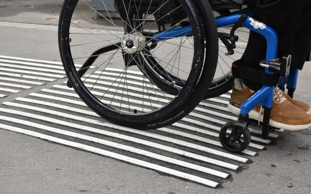
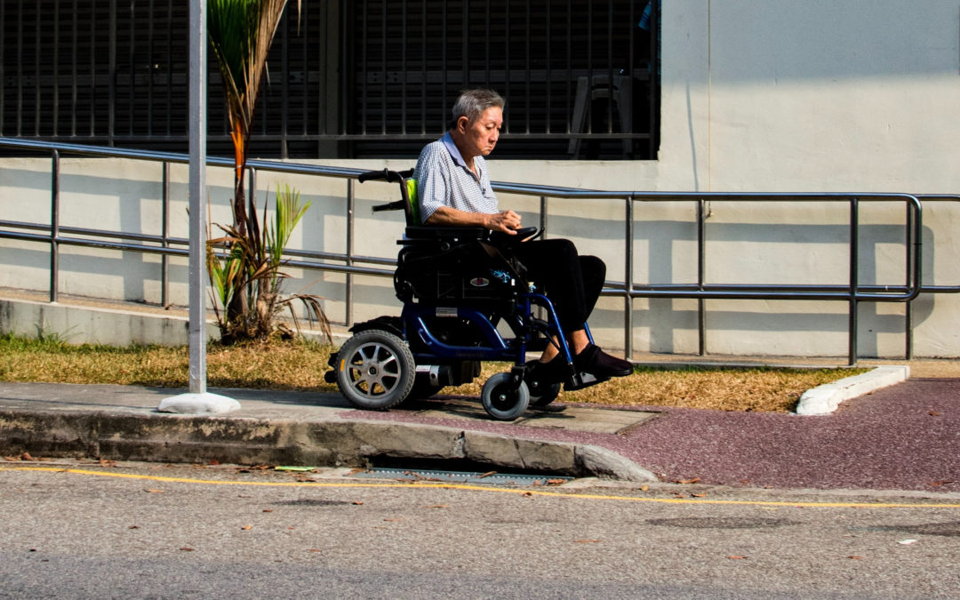
Thanks to open data, people with disabilities can plan their routes accordingly. This means a blind user can select a route depending on accessible pedestrian signals. Just like a wheelchair user can focus on lowered curbs, access ramps and wide pathways to get around.

Let’s take a look at open data solutions that improve the lives of people with disabilities. 

OpenStreetMap: the free and editable map of the world

OpenStreetMap is directly managed by its community. Mappers collect accessibility data in the entire world. 

The goal is to provide people with disabilities with the best and most accurate accessibility information.

Thanks to volunteers, users can know where to find tactile paving, audio signage, handicap parking spots, tactile maps, accessible restrooms, handrails, guide paths, audio induction loops…

They can find any type of equipment to make sure they have a smooth trip when leaving the house. 

OpenStreetMap collects data on public roadways, venues and public transportation to cover all mobility areas. 

Route planners: pedestrians have the tools to find the best trip for them

Route planners like Google Maps are an everyday life tool for many of us. 

But there’s one that has caught the eye of smart cities: MaaS (Mobility as a Service). 

This trip planner gathers all modes of transportation. Whatever their capabilities are, people with disabilities can find all the information they need on public transit networks.

For now, Pittsburgh, Pennsylvania is the only American city to provide MaaS for its residents. But it’s largely deployed in Europe: Helsinki, Madrid, Antwerp, Budapest…

OpenSidewalks and AccessMap: sharing data on the built environment and roadways in the U.S.

Here we have two projects managed by Dr. Anna Caspi, director of the Taskar Center for Accessible Technology at the University of Washington, and Nick Bolten, a Postdoctoral fellow in the Paul G. Allen School of Computer Science & Engineering. 

With OpenSidewalks, the goal is to focus on pedestrians with limited mobility to connect them with accessible pathways and multimodal transport networks. 

Dr. Anna Caspi and Nick Bolten used data collected from OpenSidewalks to create AccessMap, a web application that maps the streets of Seattle, Bellingham and Mount Vernon in Washington.

But this app even goes further by catering to needs of a large variety of profiles. After all, a person using an electric wheelchair may not have the same abilities and needs as a person using a manual wheelchair. 

Taking into account the different capabilities of pedestrians is key to make sure AccessMap can enhance their mobility. 

Locations of accessible pedestrian signals

In Canada, cities like Toronto use open data to list all traffic signals in the city, including accessible pedestrian signals.

This is particularly convenient for blind and visually impaired people since they can plan their itineraries accordingly. Thanks to open data, they know exactly where APS are located.

They know they can depend on accessible pedestrian signals to cross the street with complete autonomy. 

Find out more about communicating about APS with our article:

How Cities in North America Communicate Efficiently About Accessible Pedestrian Signals: Good Examples to Follow

These examples only show one thing: that in a world that never stops changing, open data is set to be deployed across the world to make sure people with disabilities aren’t left behind

Of course, raw data can easily overwhelm anybody. It first needs to be “translated” in a language understandable by all. And for people with disabilities, it needs to be accessible whether it’s on a website or an app.

Open data is a wake-up call for universal accessibility

Open data makes accessibility issues more visible. Indeed, cities are faced with everything that’s not adapted for people with disabilities: a lack of APS, an elevated curb, no elevators at a subway network… 

But it’s not necessarily a bad thing. Because it emphasizes accessibility, it’s actually an opportunity to set things right and to reach universal accessibility. Another key concept for smart cities.

What’s the difference between accessibility and universal accessibility?

First, we need to define what accessibility and universal accessibility are.

Accessibility focuses on adapting solutions for people with disabilities to share the same experience as any other person. 

As an example, screen readers for blind people aim at ensuring they can easily use their smartphones. 

Universal accessibility, also known as universal design or design for all, focuses on providing one solution tailored to meet the needs of everybody. 

For universal design to be successful, cities first have to take into account all mobility types, intellectual and physical capabilities… from the very beginning of a project.

It’s the very core of inclusion. And it truly benefits everybody:

People with disabilities: this term comprehends those with visual, hearing, mental, intellectual or physical disabilities. Disabilities can only be plural as there are many different abilities to consider. Two people with visual impairments may not have the same needs. 

People on the autism spectrum.

ADHD people.

People with a specific learning disorder like dyslexia.

Elderly people: when we’re young, we may not need to know where the elevators are located but we’re all getting older. At some point in our life, we may have reduced mobility. Plus the world has a growing aging population in need of universal accessibility.

Illiterate people: easily understandable pictograms are essential for them.

Foreigners who don’t speak the language of the country they’re visiting…

Open data means more inclusion for all

Ultimately, that’s the power and responsibility of open data. It enhances universal accessibility, equity and inclusion:

1. Open data gives access to information.

2. It removes barriers and obstacles for users.

3. It stresses the missing links of the mobility chain.

4. It concerns every smart city but more globally, the entire world.

5. It advocates for universal accessibility for a higher quality of life.

Open data represents the first step towards universal accessibility. It shows cities how they need to improve to be more inclusive. Because everybody deserves to be comfortable getting around in their city.

Want to know more about accessibility data and smart cities? Check out these articles:

Accessibility Data Collection: a Huge Challenge for Cities and Transit Networks

How Can a Smart City Make Life Easier for People with Disabilities?

Published on April 21st, 2023

media

A long stair with escalators on both sides in a subway station

Open data makes accessibility issues more visible. Indeed, cities are faced with everything that’s not adapted for people with disabilities (…) But it’s not necessarily a bad thing. Because it emphasizes accessibility, it’s actually an opportunity to set things right and to reach universal accessibility. 

writer

Carole Martinez

Carole Martinez

Content Manager & Copywriter

stay updated

Get the latest news about accessibility and the Smart City.

other articles for you

share our article!

more articles

NEVER miss the latest news about the Smart City.

Sign up now for our newsletter.

Unsubscribe in one click. The information collected is confidential and kept safe.

powered by okeenea

The French leading company

on the accessibility market.

For more than 25 years, we have been developing architectural access solutions for buildings and streets. Everyday, we rethink today’s cities to transform them in smart cities accessible to everyone.

By creating solutions ever more tailored to the needs of people with disabilities, we push the limits, constantly improve the urban life and make the cities more enjoyable for the growing majority.

The Crosswalk: Thousands of Years of Evolution

The Crosswalk: Thousands of Years of Evolution

A crosswalk with black and white stripes used by a lot of pedestrians

The Crosswalk: Thousands of Years of Evolution

Do you know how many crosswalks are located near your home or your workplace? Do you even pay attention to them? They help us cross the street and yet, they’re invisible to us. 

But there’s more than meets the eye. Especially when we go back to Antiquity. At a time when the city of Pompeii was still a city, the first crosswalk emerged. 

Impressed yet? Wait until you see how innovating the crosswalk can be nowadays. Here, we’ll focus solely on crosswalks at signalized intersections so let’s cross the road together for a time travel across the ages. You’ll never use a crosswalk the same way as before… 

What is a crosswalk?

A crosswalk, also known as a pedestrian crossing in the UK, designates a place where pedestrians can cross the street or the road. 

It can be paved or marked to indicate pedestrians have the right-of-way. This means vehicles stop to let them cross with safety. 

What does it look like?

There’s a particularity for crosswalks in the United States: they may be marked with white stripes or not. It depends on the cities as there’s no specific regulation regarding this aspect. 

The Manual on Uniform Traffic Control Devices (MUTCD) provides two main methods for marked crosswalks:

Two parallel white lines from one side of the road to the other. The width of the lines goes from 12 to 14 inches. A stop line across lanes going into the intersection to indicate vehicles where they have to stop.

Continental stripes that look like the zebra crossings in the UK: several bars across the crosswalk from 12 to 24 inches wide. The stripes are also 12 to 24 inches apart.

These marked crosswalks represent the common ones you may have encountered in the U.S. but what did they look like when they first emerged? 

The birth of the first crosswalk

Let’s put a foot in history, a history that happened more than 2000 years ago in the ancient city of Pompeii, more precisely before the eruption of Mount Vesuvius in AD 79.

Now the ruins of Pompeii near Naples, Italy attract thousands of tourists every year who want to see what Roman life looked like. But they overlook the first ever crosswalk created.

It consisted of blocks raised on the road. Pedestrians could cross the street without having to walk onto the road itself. These blocks were implemented across the whole city enabling pedestrians to reach the streets from a sidewalk to the other. Thanks to the spaces between the blocks, horse-drawn carts could easily come and go.

1869: the failure of the first pedestrian crossing signal

Another introduction to the crosswalk appeared in December 1868 along with the first traffic lights at Parliament Square in London. 

Railroad engineer John Peake Knight came up with an innovative idea to allow pedestrians to cross this busy part of the square: two mobile signs attached to semaphore arms that were manually lowered by a policeman. They could signal the amplified red and green coloured gas lights.

But in January 1869, the gaslight exploded, killing the policeman who manipulated the semaphore arms. The tragedy put an end at the development of crosswalks and traffic lights.

The 1930s: an attempt to provide more safety to pedestrians

In the 1930s, both the United States and the United Kingdom tried to control traffic and the safety of pedestrians. More and more cars were on the roads creating more and more accidents.

Both countries tested various designs but not one in particular stuck. For example, the UK used metal studs in the road and poles on the side. These metal studs marked the crosswalk for pedestrians who could easily spot them. But it wasn’t the case for drivers. They could only feel the raised studs once their car was on them. This means it was too late for them to slow down or stop.

1951: the zebra crossing becomes the norm across the world

The first zebra crossing was implemented in October 1951 in Slough, England. After experimenting with several designs, the black and white stripes proved to be efficient: they could be easily seen by drivers and pedestrians alike from afar. High contrasting colors such as black and white also help pedestrians with low vision find the crosswalk and align to cross.

Countries all over the world have chosen the zebra crossing. They may have different variations though. But they all agree the black and white stripes ensure the safety of pedestrians. 

How can crosswalks evolve?

It’s not because black and white stripes have spread throughout the world that crosswalks can’t evolve. Especially when the safety of pedestrians is at stake.

Cities experiment with new technologies to secure crosswalks for all road users. 

3D crosswalks

An optical illusion that makes it look like the painted crosswalk is raised. The goal of 3D crosswalks is to make motorists slow down when they spot them. 

Different countries implement this creative solution: the UK, Germany, China, India and the U.S…

Crosswalk lighting

You may encounter different systems of lighting:

An embedded flashing-light system or an in-pavement flashing-light system: LED lights warn motorists that pedestrians are crossing the crosswalk. They start flashing thanks to a motion detection device. This means they’re activated as soon as a pedestrian walks up to the crosswalk.

Overhead crosswalk lights: streetlights mounted above the road so that at night time drivers can perfectly see the crosswalk. And most of all if a pedestrian is crossing. A uniform and bright light that provides better visibility and consequently, safety.

Countdown timers

A lot of countries use countdown timers for both pedestrians and motorists to know when the red signal for pedestrians will be on. 

In the United States, countdown timers have been a mandatory feature since the MUTCD’s 2009 edition. But in France, they’re only beginning to be implemented. 

Although this solution enables the safety of road users, for blind and visually impaired people countdown timers can’t help them cross the street. That’s why accessible pedestrian signals remain essential for their mobility.

The Ultimate Guide to Accessible Pedestrian Signals

From what we’ve seen, safety could be the key word to describe a crosswalk. As pedestrians, we all are vulnerable when we cross the street but we may not always be aware of it. With new technologies and new ways of conceiving roadways, pedestrian safety represents a commitment for many cities. How does your city fare about its crosswalks?

Want to know more about pedestrian safety? Check out these articles:

Vision Zero: a Revolutionary Approach to Road Safety

How to Make Shared Streets Truly Shared By All?

Blind and Visually Impaired Pedestrians: What Are Their Difficulties When Crossing the Street?

Smombies: the New Safety Challenge for Cities in the 21st Century

Published on September 23rd, 2022

© Unsplash

media

A crosswalk called zebra crossing in the UK

The first zebra crossing was implemented in October 1951 in Slough, England. After experimenting with several designs, the black and white stripes proved to be efficient: they could be easily seen by drivers and pedestrians alike from afar.

writer

Carole Martinez

Carole Martinez

Content Manager & Copywriter

stay updated

Get the latest news about accessibility and the Smart City.

other articles for you

share our article!

more articles

NEVER miss the latest news about the Smart City.

Sign up now for our newsletter.

Unsubscribe in one click. The information collected is confidential and kept safe.

powered by okeenea

The French leading company

on the accessibility market.

For more than 25 years, we have been developing architectural access solutions for buildings and streets. Everyday, we rethink today’s cities to transform them in smart cities accessible to everyone.

By creating solutions ever more tailored to the needs of people with disabilities, we push the limits, constantly improve the urban life and make the cities more enjoyable for the growing majority.

How to Create a Smart City for Deaf and Hearing Impaired People?

How to Create a Smart City for Deaf and Hearing Impaired People?

People walking in the streets of New York City

How to Create a Smart City for Deaf and Hearing Impaired People?


Is it challenging for a smart city to be accessible for deaf and hearing impaired people? Yes and no.

It is challenging in the sense that a smart city that meets the needs of the deaf community fosters inclusion. The concern is broad. But it’s not that complex to implement. 

From the conception of your smart city, take into account the difficulties met by people with hearing impairments. The smart city is the future. It needs to be exemplary in terms of accessibility.

Let’s see what an accessible smart city looks like for the deaf and hard of hearing and for you as well as decision maker.

What is a smart city?

Putting people first thanks to the use of technology. That’s how we could define what a smart city is.

It relies on information and communication technology (ICT) and the Internet of Things (IoT) to connect residents with their city.

This means a smart city serves its people. It collects data and information from people, transportation, devices and buildings. Everything that enables a smart city to improve its operational services.

That’s what makes people’s lives easier. And we can even go further by ensuring the smart city is accessible for deaf and hearing impaired people. 

The deaf community needs to easily access information on public transportation, real-time traffic… A smart city represents the perfect opportunity to foster inclusion.

What solutions can you find in a smart city for deaf and hearing impaired people?

The question could also be: what do deaf and hard of hearing people need to fully enjoy their city? Let’s take a closer look at their struggles in a regular city and the solutions that can be found in a smart one:

Difficulties of the hearing impaired

Solutions for an accessible smart city

Accessing real-time information on public transit: it may only be available through audio.

The MaaS platform: it regroups all modes of public transit at the disposal of users. Deaf and hearing impaired people can plan their trip according to their preferences. 

Having real-time traffic information on buses

Smart urban furniture like smart benches where users can charge their phones and get free WiFi. If installed at a bus stop, deaf and hard of hearing people can access real-time information about the bus timetables.

Having real-time traffic information when driving

A GPS with real-time traffic updates like Garmin or TomTom.

Finding their way in a complex venue like a shopping mall or a public transport network: they may lack visual signage.

An indoor navigation app like Evelity can help them find their bearings. The app adapts to the user’s profile. Deaf and hard of hearing people have text instructions.

Communicating with hearing employees: the venue may not have audio induction loops and the staff may lack training in knowing how to interact with deaf or hard of hearing people. 

An instant transcription app like Ava: the conversation is transcribed for deaf people who don’t have to lip-read.

A live transcription app for phone calls like RogerVoice: when phoning a venue to make enquiries, people with hearing impairments receive a typed text of what the other person is saying. They can reply thanks to voice synthesis.

Of course, there are solutions to conceive a smart city that meets the needs of different categories of people like smart buildings.

These smart infrastructures aim at enhancing the user experience. From their conception, everything is designed to meet the needs of people: the elderly, people with disabilities with various capabilities… 

Just like a smart city, smart buildings collect and share data for users. Deaf and hearing impaired people can easily have access to any information within a smart building. Especially since they rely on phygital to provide universal accessibility.

Check out more information about smart buildings:

The 5 Keys of Tomorrow’s Smart Building 

As you can see, the most important challenge for a smart city to be accessible and inclusive for deaf and hearing impaired people is to maintain the chain of information at all times.

A smart city is molded to suit its residents. Even though technology is at its center, it’s managed and controlled by humans. It’s at the service of deaf and hard of hearing people and ensures accessibility.

Why should you focus on an accessible smart city for deaf and hard of hearing people?

You want a smarter, better and more efficient city? Then focusing on conceiving an accessible smart city is the best way to achieve it.

There are many benefits in creating a smart city fit for deaf and hearing impaired people:

Your city works as an ally: a smart city easily removes accessibility barriers like accessing information for the deaf community.

Your city is at the forefront of inclusion: keep in mind inclusion is not a trend. It’s meant to stay. What you implement has a purpose and truly makes a difference.

Your city is more effective thanks to data collection: you can analyze different types of information regarding the operational services of your smart city. This means you can know how deaf and hearing impaired people get around and what they need to make their lives easier.

Your city invests in what benefits its residents: through data collection, you know where to inject your money. You can better spend your city’s budget on projects that truly meet the needs of deaf and hard of hearing people. 

As you can see, the smart city you conceive can be accessible to the 48 million of deaf and hearing impaired people who live in the United States. Inclusive solutions regarding communication and information represent a true asset to put your city on the map. You have the opportunity to better serve different categories of people. It’s up to you to seize it.

Want to know more about the issues of the deaf community? Check out these articles:

12 Tips to Welcome a Deaf or Hard of Hearing Person

Hearing Impaired People: a Multitude of Profiles for Different Needs

5 Must-Have Apps for Deaf and Hard of Hearing People in 2022

Published on September 9th, 2022

media

The tram of Cincinnati passing in the city

The most important challenge for a smart city to be accessible and inclusive for deaf and hearing impaired people is to maintain the chain of information at all times.

writer

Carole Martinez

Carole Martinez

Content Manager

stay updated

Get the latest news about accessibility and the Smart City.

other articles for you

share our article!

more articles

NEVER miss the latest news about the Smart City.

Sign up now for our newsletter.

Unsubscribe in one click. The information collected is confidential and kept safe.

powered by okeenea

The French leading company

on the accessibility market.

For more than 25 years, we have been developing architectural access solutions for buildings and streets. Everyday, we rethink today’s cities to transform them in smart cities accessible to everyone.

By creating solutions ever more tailored to the needs of people with disabilities, we push the limits, constantly improve the urban life and make the cities more enjoyable for the growing majority.

How to Create a Smart City for Blind and Visually Impaired People?

How to Create a Smart City for Blind and Visually Impaired People?

A blind woman is using Evelity as she's about to enter a smart building

How to Create a Smart City for Blind and Visually Impaired People?


Une ville intelligente pour les personnes aveugles et malvoyantes leur simplifie la vie, notamment en matière de mobilité. Elles ont besoin de transports en commun efficaces, de savoir à quelle heure prendre le bus, de disposer d’itinéraires sans obstacle, d’activer facilement les feux piétons…

Concrètement, cela signifie qu’ils doivent être mieux connectés aux services opérationnels de leur ville. Et c’est précisément ce que fait une ville intelligente. Mais pour mieux répondre à leurs besoins, une ville intelligente doit être accessible et inclusive. 

Comment une ville peut-elle être intelligente ? Comment concevoir une ville intelligente accessible ? Découvrons les solutions numériques qui connectent les personnes aveugles et malvoyantes à la ville intelligente !

Qu’est-ce qu’une ville intelligente ?

Une ville intelligente est avant tout une question de connectivité. Elle relie les habitants à leur ville. Quel est son objectif précis ?

En résumé, une ville intelligente est au service de ses habitants et de ses touristes. Son objectif est de leur simplifier la vie pour qu’ils puissent en profiter pleinement. 

Mais qu’est-ce qui fait qu’une ville est intelligente ? Comment fonctionne une ville intelligente ? 

Tout repose sur les technologies de l’information et de la communication (TIC) et l’Internet des objets (IoT). Une ville intelligente s’appuie sur la collecte de données auprès des habitants, des appareils, des bâtiments et des transports afin d’améliorer ses services opérationnels.

Cela signifie qu’une ville intelligente s’appuie sur la technologie pour mieux servir sa communauté . Par conséquent, une ville intelligente est efficace : elle offre aux usagers des transports en commun des informations en temps réel sur le trafic, les horaires, les itinéraires optimisés…

Pour nous, à Okeenea , une ville intelligente représente la porte d’entrée vers une ville plus accessible et inclusive . Après tout, si son seul objectif est d’aider ses citoyens à se déplacer plus facilement en ville, elle inclut les personnes handicapées. 

Et dans cet article, nous nous concentrerons sur les personnes aveugles et malvoyantes qui ont besoin de se sentir en sécurité et libres de se déplacer avec plus de spontanéité et d’indépendance dans leur ville intelligente. 

Comment concevoir une ville intelligente adaptée aux personnes aveugles et malvoyantes ?

Quelles solutions numériques pouvez-vous mettre en œuvre dans votre ville intelligente pour répondre aux besoins des personnes malvoyantes ? La mobilité étant l’un des enjeux les plus importants pour les personnes aveugles et malvoyantes , nous nous concentrerons sur cet aspect.

Voyons comment vous pouvez favoriser l’accessibilité et l’inclusion :

Bancs connectés : même notre mobilier urbain peut être intelligent. Un banc solaire connecté permet aux utilisateurs de recharger leur téléphone et d’accéder au Wi-Fi gratuit. Et bien sûr, ils peuvent également s’asseoir pour se reposer un moment. Une personne aveugle peut attendre à un arrêt de bus et utiliser le Wi-Fi pour connaître précisément l’heure d’arrivée du bus. Une solution simple pour accéder à l’information en temps réel. 

Vous pouvez installer des bancs intelligents dans les parcs, les abribus, les places, les arènes, les centres commerciaux, les universités… Découvrez des fabricants comme EnGoPlanet , Strawberrye , SEEDiA … 

Safe Smart CLE : une initiative lancée à Cleveland, dans l’Ohio, vise à remplacer les lampadaires par des LED. L’objectif est de réaliser des économies d’argent et d’énergie tout en garantissant la sécurité de tous les citoyens. Des caméras sont installées aux points chauds de la criminalité, dans les rues principales et aux intersections. Les LED bénéficieront aux personnes malvoyantes , car elles ont besoin d’un bon éclairage pour se déplacer en toute sécurité. 

MaaS : un planificateur d’itinéraires regroupant tous les modes de transport. Les personnes aveugles et malvoyantes peuvent accéder en temps réel à des informations sur le trafic, les réseaux de transports en commun ou la mobilité partagée. La plateforme s’adapte aux besoins de l’utilisateur. 

La mobilité en tant que service est née en Finlande mais est désormais mise en œuvre dans plusieurs villes européennes comme Madrid, en Espagne, Budapest, en Hongrie, Anvers, en Belgique… La ville de Pittsburgh, en Pennsylvanie, utilise depuis peu le MaaS.

Wayfindr : une technologie de navigation intérieure spécialement conçue pour les personnes aveugles et malvoyantes. Elle intègre une navigation audio pour supprimer les obstacles à l’accessibilité rencontrés dans les lieux publics. 

Wayfindr est une organisation à but non lucratif basée à Londres, au Royaume-Uni. Il s’agit de la première norme internationalement reconnue pour la navigation audio accessible. 

NaviLens : une application de navigation intérieure développée par une entreprise espagnole à Murcie. Les personnes aveugles et malvoyantes utilisent l’appareil photo de leur smartphone pour scanner des QR codes disposés au sol en suivant des indications tactiles. 

Cette solution phygitale équipe principalement les réseaux de transports en commun de Murcie et de Barcelone. 

Evelity : notre application de navigation intérieure a été conçue pour les personnes en situation de handicap. Elle s’adapte au profil de chaque utilisateur. Ainsi, Evelity fournit des instructions audio étape par étape aux utilisateurs aveugles et malvoyants, et permet aux utilisateurs ayant des handicaps et des capacités différents de la configurer selon leurs besoins. 

Notre application d’orientation est idéale pour les lieux complexes où les déplacements peuvent être difficiles pour les personnes malvoyantes. Evelity équipe le métro de Marseille . Elle est actuellement testée par les New-Yorkais à la station JaySt-MetroTech

Mais Evelity est également utile dans les musées : l’application guide les visiteurs aveugles et malvoyants d’une salle d’exposition à l’autre et leur fournit des informations contextuelles sur les œuvres. Elle fonctionne comme un outil de médiation culturelle. La Maison Victor Hugo à Paris a choisi Evelity pour offrir à ses visiteurs une expérience unique et interactive .

Et c’est exactement à cela que servent les solutions phygitales.

Qu’est-ce qu’une expérience phygitale et comment peut-elle améliorer l’accessibilité de votre lieu ?

aBeacon : un feu piéton accessible , également développé chez Okeenea. Il collecte des données pour les villes intelligentes afin de connaître le nombre de fois où les personnes aveugles et malvoyantes l’ont activé. L’ouverture des données est également essentielle pour que les piétons malvoyants sachent quels passages piétons sont équipés de feux piétons accessibles . Ces informations leur permettent de créer leurs propres itinéraires accessibles. De plus, aBeacon peut être activé selon trois modes différents : un simple bouton-poussoir, une télécommande et une application pour smartphone

La télécommande et l’application pour smartphone réduisent la pollution sonore, car aBeacon ne s’active qu’en cas de nécessité. Une activation à distance et à la demande permet aux personnes aveugles et malvoyantes de mieux repérer le début du passage. 

Ce feu piéton accessible et innovant est actuellement testé sur un passage piéton de New York. Les premiers témoignages utilisateurs sont très positifs. Les piétons aveugles et malvoyants apprécient les différents modes d’activation du feu aBeacon. 

Pourquoi aBeacon change-t-il la donne en matière de signalisation piétonne accessible ?

Balises audio NAVIGUEO+ HIFI : situées à des points d’intérêt comme l’entrée d’une station de métro ou d’un lieu public, elles fournissent des informations pratiques aux personnes malvoyantes. Elles peuvent ainsi mieux localiser l’entrée d’un bâtiment. Tout comme aBeacon, ces balises audio que nous avons conçues sont déclenchables par une télécommande et une application smartphone. 

L’exemple de Marbourg : une ville intelligente pour les personnes aveugles et malvoyantes 

Vous n’avez peut-être jamais entendu parler de Marbourg, en Allemagne, mais cette ville illustre parfaitement la manière dont les villes intelligentes peuvent améliorer l’accessibilité et l’inclusion. Elle est souvent surnommée la Mecque des aveugles par les journaux.

Cette ville intelligente a été conçue en tenant compte des besoins des personnes aveugles et malvoyantes. Elle a mis en œuvre :

Feux de circulation qui bipent,

Arrêts de bus parlants,

Signaux tactiles de dangers ou d’obstacles,

Cartes et plans d’étage en relief,

Menus en braille dans les restaurants…

Toutes ces solutions permettent aux personnes aveugles et malvoyantes de profiter pleinement de leur ville intelligente. Mais la clé de leur succès réside dans la promotion d’une culture où les habitants sont habitués à interagir les uns avec les autres, quels que soient leurs handicaps et leurs capacités. 

L’acceptation culturelle des personnes aveugles et malvoyantes a rendu la ville intelligente de Marbourg unique dans son approche. Cela prouve qu’en intégrant l’accessibilité et l’inclusion à la conception d’une ville intelligente, on crée une ville centrée sur le bien-être de ses habitants.

Pourquoi une ville intelligente pour les personnes aveugles et malvoyantes deviendra-t-elle la nouvelle norme ? 

Cette question est en réalité complexe. Une ville intelligente qui répond aux besoins des personnes aveugles et malvoyantes doit devenir la norme. Mais elle doit en faire autant pour toutes les personnes en situation de handicap. Nous serons encore plus inclusifs : une ville intelligente doit s’adapter à tous, qu’ils soient à mobilité réduite ou non. 

Puisque nous nous concentrons ici sur la mobilité des personnes malvoyantes dans une ville intelligente, explorons les difficultés auxquelles elles sont confrontées :

Naviguer sur des itinéraires comportant des obstacles ou des barrières (lorsqu’il y a des travaux de voirie par exemple),

Traverser la rue lorsqu’il n’y a pas de signalisation piétonne accessible,

Repérer le début du passage pour appuyer sur le bouton poussoir afin d’actionner l’APS,

Localiser l’entrée d’un bâtiment,

Localiser l’entrée d’un bus ou de tout autre transport en commun,

Accéder aux informations sur les horaires des transports en commun, la circulation… quand elles ne sont pas vocalisées,

Se déplacer dans une rue partagée ,

Se déplacer dans un lieu complexe…

Une ville intelligente permet aux personnes aveugles et malvoyantes de se déplacer facilement. Nous avons évoqué précédemment la manière dont elle collecte des informations et des données. Les données ouvertes concernant les travaux de voirie peuvent leur être utiles. Elles peuvent ainsi identifier les voies bloquées et créer leur propre itinéraire sans obstacle pour mieux se déplacer en ville. 

Découvrez-en plus sur leurs déplacements en ville avec notre article :

Piétons aveugles : quelles sont leurs difficultés lorsqu’ils traversent la rue ?

Les États-Unis comptent environ 12 millions de personnes souffrant de déficience visuelle . Ce chiffre ne couvre même pas l’ensemble du comté de Los Angeles. Nous ne pouvons plus nous permettre de créer des villes où une partie de ses habitants peinent à se déplacer et vivent dans l’inconfort.

Il est temps de promouvoir l’accessibilité et l’inclusion pour concevoir une ville intelligente où les personnes aveugles et malvoyantes peuvent facilement se déplacer. La ville doit s’adapter à elles, et non l’inverse. 

Vous souhaitez en savoir plus sur les solutions numériques pour les personnes malvoyantes ? Consultez ces articles :

Technologies d’assistance pour les personnes handicapées : l’assistance humaine est-elle vraiment obsolète pour leur mobilité ?

Le smartphone : une révolution pour les aveugles et les malvoyants !

Publié le 12 août 2022

media

A blind man has reached the other side of the crossing after actuating accessible pedestrian signals

Cultural acceptance of the blind and visually impaired people made the smart city of Marburg unique in its approach. This proves that from the moment you integrate accessibility and inclusion into the conception of your smart city, you create a city focused on the wellbeing of its residents.

writer

Carole Martinez

Carole Martinez

Content Manager

stay updated

Get the latest news about accessibility and the Smart City.

other articles for you

share our article!

more articles

NEVER miss the latest news about the Smart City.

Sign up now for our newsletter.

Unsubscribe in one click. The information collected is confidential and kept safe.

powered by okeenea

The French leading company

on the accessibility market.

For more than 25 years, we have been developing architectural access solutions for buildings and streets. Everyday, we rethink today’s cities to transform them in smart cities accessible to everyone.

By creating solutions ever more tailored to the needs of people with disabilities, we push the limits, constantly improve the urban life and make the cities more enjoyable for the growing majority.

How to Create a Smart City for People with Physical Disabilities?

How to Create a Smart City for People with Physical Disabilities?

A wheelchair user can easily get around in the city thanks to lowered curbs and accessible sidewalks

How to Create a Smart City for People with Physical Disabilities?


Pourquoi se concentrer sur la création d’une ville intelligente pour les personnes en situation de handicap physique ? La réponse est simple : une ville mieux connectée, conçue pour répondre à leurs besoins, permet de supprimer les obstacles à l’accessibilité et de favoriser l’inclusion. Une ville intelligente se concentre sur l’optimisation de ses services. C’est l’occasion idéale de placer au cœur de ses préoccupations ceux qui sont habituellement les plus négligés.

La ville intelligente est connectée à tous ses citoyens, y compris ceux qui ne correspondent pas aux normes sociales. Plusieurs solutions numériques permettent aux personnes en situation de handicap moteur de mieux s’orienter en ville, d’utiliser plus efficacement les transports en commun et de profiter pleinement de leur environnement.

Voyons ce qu’est exactement une ville intelligente et comment elle peut faciliter la vie des personnes handicapées physiques !

Qu’est-ce qu’une ville intelligente ?

Une ville intelligente peut être définie comme une ville intelligente. Elle utilise les technologies de l’information et de la communication (TIC) pour améliorer ses services opérationnels. 

Une ville intelligente collecte des données auprès des citoyens, des appareils, des bâtiments et des transports, et les partage avec le public pour les mettre au service de ses citoyens. C’est ce qu’on appelle l’Internet des objets (IoT).

Comme vous pouvez le constater, une ville intelligente est une ville connectée : elle relie les responsables et les services municipaux à la communauté, facilitant ainsi les interactions entre les deux parties. Les solutions numériques garantissent cette interaction et cette efficacité.

En étant plus connectées, les villes peuvent améliorer la circulation, devenir plus durables et économiser de l’énergie, réduire les coûts, promouvoir les transports actifs…

Shanghai est la ville intelligente numéro un au monde. Sa plateforme publique « Citizen Cloud » connecte ses citoyens à plus de 1 000 services. Un point d’accès unique permet aux résidents d’accéder à tout ce que la ville a à offrir.

Comment concevoir une ville intelligente adaptée aux personnes handicapées physiques ?

Une ville intelligente améliore le quotidien des personnes en situation de handicap physique. Il nous faut simplement repenser ce qu’elle peut leur apporter. Notamment dans les domaines suivants :

Mobilité intelligente

Comme indiqué précédemment, se déplacer peut être difficile pour les personnes handicapées motrices. Pourtant, comme tout le monde, elles doivent se rendre au travail, faire leurs courses, rendre visite à leurs amis… Cela implique d’utiliser les transports en commun, les trottoirs et les places de stationnement. 

C’est là qu’intervient la mobilité intelligente : elle consiste en un réseau de transport et de mobilité intelligent. Elle offre aux citoyens différents modes de transport : véhicules motorisés, véhicules électriques, véhicules autonomes, transports en commun, trottinettes, services de covoiturage à la demande avec Uber et Lyft…

Examinons de plus près quelques solutions de mobilité intelligente que vous pouvez mettre en œuvre dans votre ville ! Elles pourraient vous inspirer.

MaaS : une plateforme qui répertorie tous les moyens de transport existants auprès des utilisateurs. MaaS signifie « Mobility as a Service ». Cette solution leur propose la meilleure option de mobilité en fonction de leurs besoins et du trafic, avec des informations en temps réel. 

Plusieurs villes européennes utilisent le MaaS pour faciliter les déplacements de leurs citoyens. Ce service a récemment fait son apparition aux États-Unis, à Pittsburgh.

Parquery : une solution de stationnement intelligent basée sur le cloud qui permet aux automobilistes de savoir où se garer. Idéal pour décongestionner le trafic, car trop de conducteurs tournent en rond pour trouver une place. Elle leur fournit des informations sur l’occupation du parking en temps réel. C’est également une solution efficace pour trouver les places de stationnement les plus proches de leur destination et réduire le temps de marche.

Plusieurs villes suisses l’ont mis en place. Aux États-Unis, on trouve Parquery à Greenville, en Caroline du Sud.

Streetco : une plateforme GPS piétonne collaborative spécialement conçue pour les personnes à mobilité réduite. Elle leur propose des itinéraires optimisés afin d’éviter les obstacles, comme les travaux. Les personnes en situation de handicap physique peuvent utiliser Streetco pour rendre leur ville intelligente accessible.

Cette application est principalement présente dans les villes françaises mais elle a également foulé le sol américain à San Francisco. 

Projet AI for Inclusive Urban Sidewalks : une collaboration de G3ict (l’Initiative mondiale pour les TIC inclusives) avec Smart Cities for All et TCAT (Taskar Center for Accessible Technology) pour fournir les données ouvertes d’accessibilité OpenSidewalks et les itinéraires personnalisés AccessMap. 

Ce projet est présent dans des villes du monde entier. Il s’agit d’une initiative qui lève les obstacles à l’accessibilité pour les personnes en situation de handicap physique, leur permettant ainsi de profiter pleinement de leur ville intelligente.

Bâtiments intelligents

Peut-on avoir des villes intelligentes sans bâtiments intelligents ? Certainement pas. 

Les bâtiments intelligents visent à améliorer le confort de leurs utilisateurs tout en optimisant leur gestion et leur consommation. Ils poursuivent fondamentalement le même objectif que les villes intelligentes. 

Ils utilisent des technologies numériques innovantes pour une approche centrée sur l’utilisateur. En l’occurrence, les utilisateurs en situation de handicap moteur. Dans une ville intelligente, des bâtiments intelligents accessibles sont essentiels à leur confort et à leur bien-être. 

Dès leur conception, ils doivent prendre en compte les besoins des personnes en situation de handicap physique. Ils doivent s’adapter à eux et non l’inverse.

Le phygital peut être un concept intéressant pour les bâtiments intelligents. Il connecte le monde physique au monde numérique pour offrir aux utilisateurs une expérience interactive unique. 

Qu’est-ce que cela signifie pour les personnes en situation de handicap physique ? En résumé, les bâtiments intelligents doivent respecter les directives d’accessibilité et garantir que tous leurs services soient facilement accessibles et utilisables par les personnes en situation de handicap moteur.

Une solution consiste à mettre en place une application de navigation intérieure pour guider les utilisateurs. Une application comme Evelity, créée par Okeenea , a été spécialement conçue pour les personnes handicapées. 

Evelity s’adapte au profil de chaque utilisateur. Pour les personnes en situation de handicap physique, l’application propose des itinéraires sans marches. Elle privilégie les itinéraires équipés d’un ascenseur ou d’une rampe d’accès pour faciliter leurs déplacements. 

Cette application d’orientation équipe actuellement plusieurs lieux en France : le musée de la Maison Victor Hugo à Paris, la Fondation Luma à Arles et la Rockefeller Medical University à Lyon. 

Une expérience phygitale peut garantir l’accessibilité des bâtiments intelligents. Les personnes en situation de handicap physique utilisent la technologie pour améliorer leur mobilité. C’est la raison d’être de toute ville intelligente : garantir à chaque citoyen la même qualité d’expérience. 

En savoir plus sur le phygital :

Qu’est-ce qu’une expérience phygitale et comment peut-elle améliorer l’accessibilité de votre lieu ?

Pourquoi une ville intelligente est-elle essentielle pour les personnes handicapées physiques ?

Devenir une ville intelligente représente une opportunité idéale pour les villes de devenir plus accessibles et inclusives . Cela fait des villes intelligentes un élément essentiel de notre société moderne.

Aux États-Unis, le handicap le plus courant est la déficience physique. C’est pourquoi le nombre d’Américains souffrant de déficiences motrices est si élevé : 39 millions. 

Statistiques sur le handicap aux États-Unis : au-delà des chiffres, pour une société accessible et inclusive

Les personnes handicapées moteurs ont des difficultés à se déplacer en ville : 

Trottoirs endommagés, 

Manque d’ascenseurs pour les réseaux de transport en commun, 

Lieux publics inaccessibles, 

Manque de toilettes accessibles, 

Places de stationnement PMR…

Vivre dans une ville intelligente qui prend en compte les besoins des personnes en situation de handicap physique peut faire la différence. De plus, elle permet de mieux respecter l’Americans with Disabilities Act (ADA) afin de prévenir toute forme de discrimination à leur égard.

Il appartient véritablement aux villes de veiller à ce que tous leurs citoyens puissent en profiter. Les personnes en situation de handicap physique ne devraient pas avoir à s’y adapter.

Une ville intelligente conçue pour les personnes handicapées physiques présente de nombreux avantages, tant pour la ville que pour ses citoyens :

La ville intelligentePersonnes handicapées physiques
Collecte de donnéesContrôler leur mobilité
Gérer ses opérationsObtenir un meilleur accès à la ville
Répondre aux besoins des personnes handicapées motricesAvoir plus de spontanéité dans leurs déplacements
Réduire sa consommationUtiliser les services de la ville comme tout le monde 
Attirer plus de résidents et de touristesAvoir des informations en temps réel
Améliorer la qualité de vie de tous les citoyensConnaître les lieux accessibles
Améliorer l’inclusionLocalisation des services accessibles (toilettes, places de stationnement PMR…)

Faites connaître votre ville en créant une ville intelligente adaptée aux personnes en situation de handicap physique. Vous disposez désormais de plusieurs initiatives et solutions pour éliminer définitivement les obstacles à l’accessibilité.

Vous souhaitez en savoir plus sur la conception de villes intelligentes accessibles ? Consultez nos articles :

Le handicap comme moteur d’innovation pour la ville intelligente 

Comment une ville intelligente peut-elle faciliter la vie des personnes handicapées ?

Créer une société accessible et sans obstacles grâce à une conception inclusive : un renouvellement constant

Publié le 29 juillet 2022

media

Pedestrians crossing the street in the smart city of New York

Living in a smart city that takes into account the needs of people with physical disabilities can make a difference. (…) It’s truly up to the cities to make sure all their citizens can enjoy them. 

writer

Carole Martinez

Carole Martinez

Content Manager

stay updated

Get the latest news about accessibility and the Smart City.

other articles for you

share our article!

more articles

NEVER miss the latest news about the Smart City.

Sign up now for our newsletter.

Unsubscribe in one click. The information collected is confidential and kept safe.

powered by okeenea

The French leading company

on the accessibility market.

For more than 25 years, we have been developing architectural access solutions for buildings and streets. Everyday, we rethink today’s cities to transform them in smart cities accessible to everyone.

By creating solutions ever more tailored to the needs of people with disabilities, we push the limits, constantly improve the urban life and make the cities more enjoyable for the growing majority.

How to Make Shared Streets Truly Shared by All?

How to Make Shared Streets Truly Shared by All?

A woman is about to cross the tram rails

How to Make Shared Streets Truly Shared by All?


Shared streets, curbless streets, shared spaces, all these facilities have been on the rise for the last fifteen years. Based on the removal of the conventional division between sidewalk and roadway, they lead to a decline in car domination, a good way to improve safety, quality of life and the attractiveness of city centers! At least on paper. In reality, experience shows that the most vulnerable users do not always find their way there. Among them are seniors and people who are blind or visually impaired. Sharing the street with bicycles and motor vehicles reinforces the sense of insecurity when navigating those spaces.

How to reconcile road sharing and comfort for all? How to ensure that shared streets do not become zones closed to the most fragile pedestrians? In this article, we provide you with a series of recommendations resulting from international experience so that shared streets are truly shared by all.

What are shared streets?

Shared streets or shared spaces are zones where pedestrians, bicyclists and motor vehicles mix in the same space. The design of shared streets should suggest that the most vulnerable users have greater priority over all others. In other words, a child, an elderly or disabled pedestrian should benefit from the awareness of all other users in order to be able to move around safely. Next on the “vulnerability scale” are able-bodied pedestrians, bicyclists and other active modes of transportation, powered two-wheelers, cars and trucks.

The design of a shared street aims to reduce traffic speed and increase driver awareness. Shared streets are generally designed to produce motor vehicle operating speeds between 5 and 15 mph. Thus, design elements that suggest priority to motor vehicles and separate modes are removed. They include vertical curbs, traffic signals, pavement marking, and other conventional street elements.

It happens that curbless streets and complete streets operate quite similarly to shared streets. The recommendations we’re going to cover apply to all categories of shared spaces, regardless of their official classification.

The benefits of shared streets

The transformation of city centers into shared streets or low-speed zones has many advantages.

Pedestrian safety

Creating shared streets aims to provide more space for pedestrians, bicyclists and other active modes of transportation, while improving their safety.

Space flexibility

Compared to a conventional street, a shared street offers more flexibility. It can be easily converted into a pedestrian area when organizing markets, festivals or other events. The rest of the time, it allows access for motor vehicles even if it does not give them priority.

Improving accessibility and economic development with shared streets

When a street is too narrow to provide comfortable sidewalks that comply with accessibility standards, converting it into a shared street saves space. It is also a good way to facilitate access to shops and services for people with reduced mobility or using a stroller. If the shared street is well designed, it is likely to attract a lot of people and have a positive impact on economic development.

The recommendations we give you in this article are precisely intended to help you design safe and welcoming shared streets for everyone, in order to be able to derive all the expected benefits.

How to avoid creating zones closed to the most vulnerable users?

Title II of the Americans with Disabilities Act of 1990 provides that no person with a disability shall, because a public entity’s facilities are inaccessible or unusable, be excluded from participation in or denied the benefits of a public entity’s programs, services, or activities-including pedestrian facilities in the public right-of-way. 

The concept of shared streets was originally created on the basis of “normal” human abilities. However, in terms of human capacities, we know well that the norm does not exist. There is simply no question that certain people are deprived of essential faculties. They are already vulnerable in general, and even more exposed to close contact with motor vehicles due to the removal of physical barriers. This primarily concerns blind or visually impaired people and seniors. The absence of detectable landmarks such as curb lines creates orientation difficulties for them and increases their feeling of insecurity. In addition, negotiating priorities in shared streets involves eye contact, which is obviously impossible for blind or visually impaired people. The same goes for “smombies ”, smartphone addicts who never look up from their screen, even if, in their case, it’s voluntary.

In a conventional street, visually impaired people rely above all on detectable edges, such as curbs and building faces to keep their path. They identify the location of pedestrian crossings thanks to the noise of traffic flows and learn to analyze intersections to cross at the right time. Detectable warning surfaces alert them as soon as they are about to cross the road. The accessible pedestrian signals (APS) associated with the traffic lights are also very useful for identifying crosswalks and crossing safely. In an environment where traffic flows are not regulated, all these landmarks disappear. The shared streets are also used a lot by silent vehicles such as bicycles or electric scooters.

Seniors also face similar challenges. Promiscuity with motor vehicles, bicycles and scooters creates a feeling of insecurity. Indeed, age-related sensory and cognitive impairments complicate risk assessment. Many seniors say they avoid shared streets for fear of an accident.

The fact that these vulnerable users avoid shared streets also calls accident data into question. How can we say that these developments are less accident-prone if part of the population avoids them?

What design rules for a space truly shared by all?

The rules for designing a shared street aim to naturally induce a reduction in speed. The removal of signs, curbs and road markings delimiting spaces aims to reduce the illusion of safety and create uncertainty in the minds of drivers to encourage them to slow down. But experience shows that removing signs is not enough to change behavior overnight.

Show Pedestrian Priority

The first step to take when designing a shared street is to make its operation visible and to leave no ambiguity about the priority scheme. This requires the installation of Share Road Signs at any entry/exit of shared streets, but also at intersections so as to remind drivers of the pedestrian priority.

The facilities present in a shared street should also encourage pedestrians to appropriate space and drivers not to feel at home. Among them are:

Creating chicanes, raised crossings and textured paving to calm the traffic speed,

Installing seats and benches,

Introducing revegetation by planting trees, installing planters and vegetable plots,

Designing a lighting homogeneous over the entire area.

Create a comfort zone for pedestrians

The concept of “comfort zone” for pedestrians was first introduced in England and then in the United States. It is described in the good practice guide published in 2017 by the Federal Highway Administration (FHWA). The comfort zone consists in an obstacle-free pedestrian route where pedestrians can move around safely without risk of conflict with other users. Where possible, the comfort zone should be aligned in proximity with building faces.

The guide recommends providing a space between the buildings and the comfort zone to allow the installation of shop signs and storefronts without them invading on the walkway.

Also to preserve the comfort zone, lighting fixtures, road signs, street furniture and café terraces should be grouped together in a “furniture zone” located between the comfort zone and the area shared with the vehicles in the center of the street. The comfort zone should be at least six feet wide so that two pedestrians can walk side by side and comfortably pass a pedestrian walking in the opposite direction.

Provide tactile walking surface indicators and visual contrast

It would of course be counterproductive to recreate the boundaries found in conventional streets. However, it is essential that blind or visually impaired people can find their way around and move around safely. They should then find two types of detectable surfaces: warning surfaces and directional indicators.

Detectable warning surfaces should be installed at each entry/exit of the shared street and at any intersection where vehicles have right-of-way.

Directional indicators should be installed along the comfort zone so that visually impaired people can move around without encountering obstacles. If the comfort zone is more than 11 feet wide, it is better to install directional indicators in the middle of it. If it’s less than 11 feet wide, it is better to place them on the side of the buildings while leaving space for shop signs and storefronts.

There are currently no specifications for the use of directional indicators in the United States but it can be referred to the international standard ISO 23599:2012. This guarantees that directional indicators will be easily detectable and identifiable by people who are blind or have low vision.

In the context of a new street design, it would be a shame not to take advantage of this to integrate directional indicators into the architectural design. The color of this device should contrast with the adjoining surface, either light on dark or dark on light. It should be detectable underfoot and with a white cane. It is essential to organize a consultation bringing together a maximum of users of different profiles to choose the best system. It is unfortunately common that surface treatments theoretically used to provide tactile and visual contrast are totally imperceptible to the main parties concerned.

Install audio signals

The removal of traffic lights and their associated accessible pedestrian signals (APS) from shared streets deprives blind or visually impaired people of valuable landmarks. It is therefore important to restore them by installing audio beacons. These beacons can be activated from a distance with a remote control or the MyMoveo app by Okeenea. The audio beacons have the advantage of providing useful information to visually impaired pedestrians without altering the architectural design of shared streets. Audio beacons can be attached to public lighting poles or on building faces.

We recommend installing sound beacons:

At the entries and exits of the shared street to inform visually impaired pedestrians that they are entering a shared space,

At intersections to make it easier for them to cross the streets,

Whenever an essential point of interest is present.

The audio messages broadcast by the beacons must inform blind or visually impaired pedestrians that they are in a shared street and provide information on its operation and the presence of detectable surfaces.

The ultimate guide to accessible pedestrian signals. I want it!

Don’t skip user consultation to conceive shared streets!

Shared streets are relatively recent facilities in the history of urban planning. We still lack perspective on the appropriation of these shared spaces by all types of users. This is why the consultation stage is essential. This consultation must involve the most varied profiles:

Pedestrian representatives,

Representatives of bicyclists,

The elderly,

Pedestrians with reduced mobility (wheelchair users or other mobility aids: canes, walkers, etc.),

Blind or visually impaired people, as well as orientation and mobility specialists,

People with an auditory, mental, intellectual or cognitive disability,

Maintenance and operation staff who are responsible for roads, vegetation and street furniture.

Key stakeholders should be involved at every stage of the planning and design process, from needs assessment to final design.

Care must be taken to ensure accessibility at all stages of the consultation. Remember to arrange:

Meeting rooms accessible to people with reduced mobility,

A support service for people requiring orientation assistance,

Presentation materials in large print, audio, Braille or accessible digital format (depending on attendee needs),

Sign language interpreters (ASL),

Induction loops or other amplification system for hearing-impaired people with hearing aids (depending on attendee needs),

Contrasting plans and 3D models to facilitate the representation of visually impaired people,

A construction game (Lego or other) to allow participants to represent and manipulate the facility components…

This list is not exhaustive. Remember to ask the participants in the consultation meetings about their specific needs.

In conclusion, the transformation of city centers has accelerated considerably since the start of the COVID-19 pandemic. We can only rejoice at the increase in the place given to walking and other active modes of mobility. But let’s keep in mind that not everyone has the same physical, sensory, cognitive or intellectual abilities. Let’s make sure that everyone finds their place in these new attractive urban environments. We hope these guidelines help you design shared spaces that are truly shared by all.

Want to know how to design an inclusive and safe city for all? Check out our articles:

Vision Zero: A Revolutionary Approach to Road Safety

Removing Traffic Lights vs Pedestrian Safety: a Guide to Inclusive Streets

How Can a Smart City Make Life Easier for People with Disabilities?

How Can Accessible Pedestrian Signals Become Responsive to COVID-19?

Published on March 25th, 2022

media

A blind pedestrian is walking towards a staircase

The concept of shared streets was originally created on the basis of “normal” human abilities. However, in terms of human capacities, we know well that the norm does not exist. There is simply no question that certain people are deprived of essential faculties. 

writer

Lise Wagner

Lise Wagner

Accessibility Expert

stay updated

Get the latest news about accessibility and the Smart City.

other articles for you

share our article!

more articles

Hearing Impaired People: a Multitude of Profiles for Different Needs

Hearing Impaired People: a Multitude of Profiles for Different Needs

Hearing Impaired People: a Multitude of Profiles for Different Needs  Did you know that hearing impaired people have several profiles and that the way they identify themselves is important? You may be familiar with deaf and hard of hearing people but for each of...

NEVER miss the latest news about the Smart City.

Sign up now for our newsletter.

Unsubscribe in one click. The information collected is confidential and kept safe.

powered by okeenea

The French leading company

on the accessibility market.

For more than 25 years, we have been developing architectural access solutions for buildings and streets. Everyday, we rethink today’s cities to transform them in smart cities accessible to everyone.

By creating solutions ever more tailored to the needs of people with disabilities, we push the limits, constantly improve the urban life and make the cities more enjoyable for the growing majority.